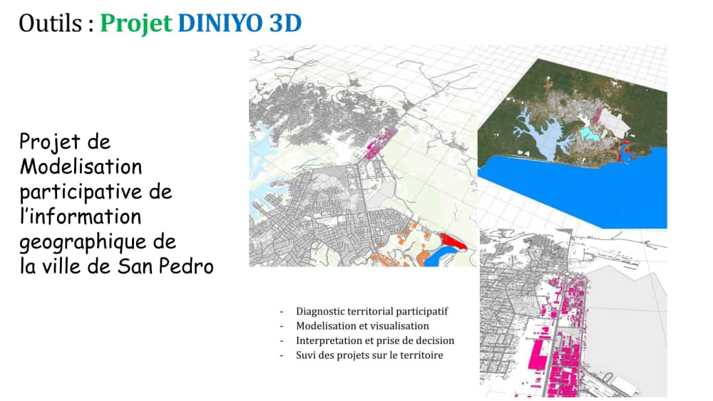


With the #DINIYO3D project, is an interactive GiS platform to help the City council of San Pédro to improve his knowledge of the urban and rural areas with geodesign tools.
Territorial diagnosis
Modelling and visualisation
Interpretation, participation and decision making
Monitoring of development projects